

UP42 AI
Use UP42 AI as the anchor for a real shortlist.
Instead of returning to a broad directory, jump straight into the strongest adjacent matchups for pricing, workflow fit, and differentiation.
Overview
Overview
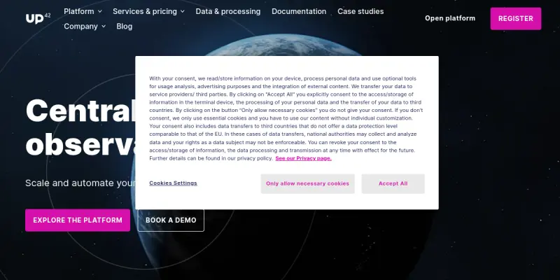
UP42 AI is a comprehensive platform designed to simplify and automate geospatial workflows for professionals across various industries, including agriculture, environmental monitoring, and urban planning. By integrating archive imagery from a vast catalog and the capability to task satellites from leading providers, UP42 AI offers a centralized solution for Earth observation operations.
Key Features
- Satellite Imagery Access: Explore a vast catalog of archive imagery from the world's leading satellite providers.
- Tasking Capability: Task satellites to capture new imagery tailored to specific project requirements.
- AI-Powered Analysis: Leverage advanced AI models to simplify complex geospatial analysis tasks.
- Workflow Automation: Automate geospatial workflows to enhance efficiency and reduce manual labor.
- Scalability: Scale operations with a platform designed to handle large volumes of geospatial data.
- Integration: Integrate with existing systems and tools for seamless workflow continuity.
Use Cases
Agriculture
UP42 AI can be used in agriculture for crop monitoring, yield prediction, and precision farming, helping farmers make data-driven decisions.
Environmental Monitoring
The platform is also useful for environmental monitoring, allowing users to track changes in land use, deforestation, and natural disaster impacts.
Urban Planning
Urban planners can utilize UP42 AI for mapping urban sprawl, monitoring infrastructure development, and planning sustainable cities.
Pricing & Plans
UP42 AI operates on a paid model, with pricing details available upon request. The cost is tailored to the specific needs of the project, including the type of imagery required, the frequency of satellite tasking, and the level of AI analysis needed.
Integrations & Compatibility
The platform is designed to be compatible with a variety of systems and tools, ensuring easy integration into existing workflows.
Who Is It For?
UP42 AI is designed for professionals and organizations involved in geospatial analysis, including those in agriculture, environmental monitoring, urban planning, and research.
Limitations
- Internet Connectivity: Requires a stable internet connection for optimal performance.
- Subscription Model: Access to advanced capabilities may require a paid subscription.
- Input Quality: The accuracy of outputs depends on the quality of user inputs.
Final Verdict
UP42 AI offers a powerful solution for automating and scaling geospatial workflows, leveraging AI to enhance efficiency and accuracy. While it may have limitations such as dependency on internet connectivity and potential costs for advanced features, it is a valuable tool for professionals in the geospatial industry.
Tool Facts
Screenshots & Interface
Pros
- ✓ Automates geospatial workflows for enhanced efficiency
- ✓ Provides access to a vast catalog of satellite imagery
- ✓ Utilizes AI for accurate and simplified geospatial analysis
Cons
- × Requires a stable internet connection for operation
- × Advanced features and high-resolution imagery may incur additional costs
- × Output accuracy is directly affected by the quality of input data
How to Use UP42 AI in Your Workflow
Integrating UP42 AI into your professional toolkit enhances efficiency by automating manual steps. By configuring it to suit your specific project requirements, you can optimize output quality and reduce project cycle times. Standard workflows involve testing the tool on simple tasks before scaling its use to complex operations.
Frequently Asked Questions
What is UP42 AI used for?
UP42 AI is a geospatial workflow automation platform for professionals. It enables users to explore archive imagery and task satellites, leveraging AI for efficient workflows.
What is the pricing model for UP42 AI?
UP42 AI uses a Paid pricing model.
What are the main advantages of UP42 AI?
The key benefits of UP42 AI include: Automates geospatial workflows for enhanced efficiency, Provides access to a vast catalog of satellite imagery, Utilizes AI for accurate and simplified geospatial analysis.
What are the main limitations of UP42 AI?
Some limitations or cons of UP42 AI are: Requires a stable internet connection for operation, Advanced features and high-resolution imagery may incur additional costs, Output accuracy is directly affected by the quality of input data.
Alternative AI Tools

Sweep AI
Sweep AI is an AI-powered coding assistant built for JetBrains IDEs. It helps developers write code faster by offering intelligent code completion and an AI agent that assists with complex development tasks. This tool is designed for programmers looking to automate portions of their workflow within JetBrains environments.

SkyWatch AI
SkyWatch AI provides commercial liability and hull insurance for drone and light aircraft operators. It offers flexible coverage plans for 107 pilots, students, and recreational users. Get instant quotes for various operational needs.
Capella Space AI
Capella Space AI provides on-demand synthetic aperture radar (SAR) satellite imagery for government and commercial users. It enables persistent monitoring through all weather conditions, day or night, without reliance on optical sensors. A key differentiator is its ability to deliver tasking and analytics within hours of a request.
Rating Details
Based on 0 ratings
Quick Comparisons
Related Tools
More AI tools from the same workflow, industry, or category.
fr3n
fr3n is a creator platform that combines a link-in-bio page, digital storefront, community spaces, and newsletters into one hub. It helps creators sell digital products, run memberships, and build an audience with first-party data.
Aveva AI
Aveva AI optimizes industrial processes and predictive maintenance by leveraging AI models to detect anomalies and support risk-based decision-making in manufacturing.
Paddle AI
Paddle AI streamlines billing, tax compliance, and revenue management for digital businesses. This SaaS platform automates financial operations, supporting global revenue generation for apps like n8n and AdGuard. It integrates essential payment processing tools into a single interface.
Honeywell Forge AI
Honeywell Forge is an industrial IoT platform that combines digital twin technology with AI to optimize facility operations. It is designed for industrial manufacturers seeking predictive maintenance and operational efficiency.
Reviews
No reviews submitted yet. Be the first to share your experience.
Write a Review
Share Your Experience
Join the community to write reviews, submit ratings, and bookmark your favorite AI tools.